
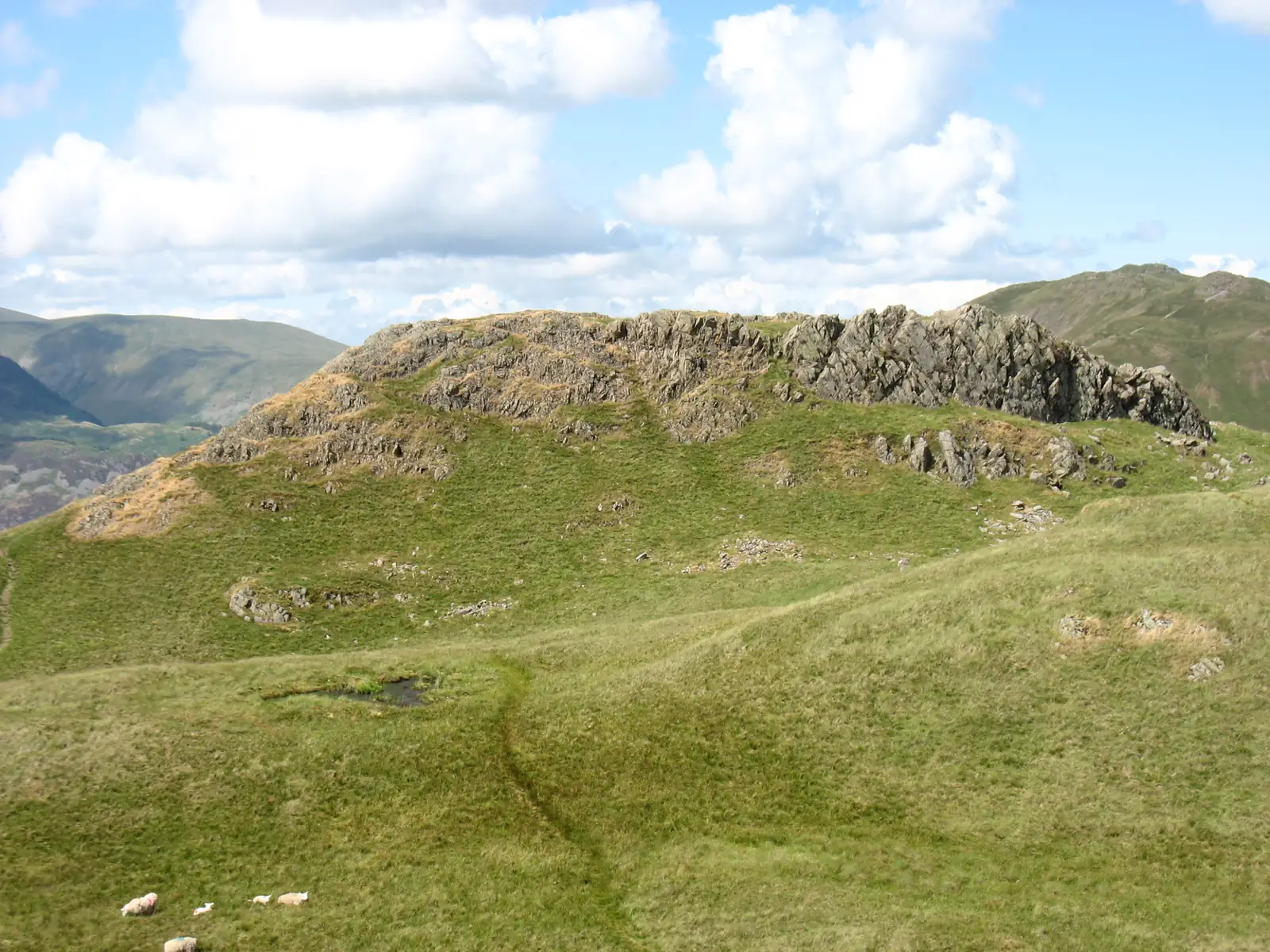

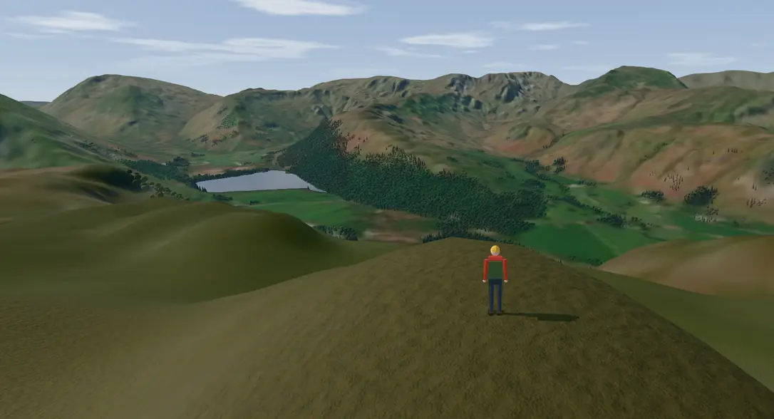
 Walk it in 3D

Is Angletarn Pikes a Wainwright?
Yes. Angletarn Pikes is one of the 214 Wainwrights: number 1 of 36 in Book 2, The Far Eastern Fells, of Alfred Wainwright’s Pictorial Guide to the Lakeland Fells.
Climbing Angletarn Pikes from Patterdale Hotel car park
Desk-checkedChecked against the map data on ; not yet walked for this page.Report a problem
Angletarn Pikes is 566 m high, 143rd of the 214 Wainwrights by height, and belongs to the Far Eastern Fells in Book 2. This route starts at the Patterdale Hotel car park in Patterdale, run by the hotel. Parking is paid, at about 150 m. The Patterdale Hotel bus stop, about 50 m away, is served by the 508 and 509.
The line is 3.3 km long and gains about 440 m. It shares its first 1.2 km with the Place Fell route. The first kilometre stays below about 170 m, crossing Goldrill Beck on Goldrill Bridge at about 0.6 km and following a lane for about 430 m.
At about 970 m a public bridleway starts the climb, and a public footpath crosses Rooking Gill at about 1.2 km. The line reaches Boredale Hause, a saddle, at about 2 km and around 370 m. A 50 m stretch of path just before it is graded hiking by OpenStreetMap; the rest of the route is not graded for difficulty on the map.
The last 900 m follow a path across open access land, crossing Freeze Beck at about 2.8 km and rising to about 525 m at 3 km and the summit at 566 m. No cairn or trig pillar is mapped at the summit point.
About 1.8 km of the line follows public footpaths and bridleways, 2.5 km crosses open access land, and about 440 m is on road. About 75 m in the first 100 m, either side of the main road, is on none of these in the data.
The GPX file is the same line, from the car park to the summit. Return the same way, or plan a longer walk with a map before you set out.
Download the GPXFree. The route is © OpenStreetMap contributors and the file is released under the Open Database Licence: you may copy, share and adapt it.
From the top
47 other Wainwrights are in line of sight from the top of Angletarn Pikes. The farthest is Bowscale Fell, 17.6 km to the north-west.
The highest of them, clockwise from north:
- Fairfield6.3 km SW
- Nethermost Pike7.0 km W
- Helvellyn7.1 km W
- Catstye Cam6.6 km W
- White Side7.8 km W
- Raise7.5 km W
- Great Dodd9.1 km NW
- Blencathra-Hallsfell Top15.7 km NW
See all 47, nearest first
- Brock Crags 1.2 km S
- Arnison Crag 2.0 km W
- The Nab 2.1 km E
- Rest Dodd 2.3 km SE
- Place Fell 2.3 km N
- Beda Fell 2.8 km NE
- Hartsop Dodd 3.0 km S
- The Knott (High Street) 3.2 km SE
- Birks 3.3 km W
- Gray Crag 3.4 km SE
- Rampsgill Head 3.6 km SE
- High Raise (High Street) 3.8 km E
- Hartsop above How 4.1 km SW
- Steel Knotts 4.3 km NE
- Glenridding Dodd 4.3 km NW
- High Hartsop Dodd 4.5 km SW
- St Sunday Crag 4.6 km W
- High Street 4.7 km SE
- Wether Hill 4.7 km NE
- Stony Cove Pike (Caudale Moor) 4.8 km S
- Thornthwaite Crag 5.1 km S
- Birkhouse Moor 5.1 km W
- Hallin Fell 5.4 km N
- Loadpot Hill 5.4 km NE
- Little Hart Crag 5.5 km SW
- Middle Dodd 5.5 km S
- Sheffield Pike 5.5 km NW
- Hart Crag 5.8 km SW
- Dove Crag 5.9 km SW
- Fairfield 6.3 km SW
- Red Screes 6.3 km S
- Catstye Cam 6.6 km W
- Bonscale Pike 6.6 km NE
- Nethermost Pike 7.0 km W
- Helvellyn 7.1 km W
- High Pike (Scandale) 7.1 km SW
- Hart Side 7.3 km NW
- Ill Bell 7.4 km S
- Raise 7.5 km W
- Arthur's Pike 7.5 km NE
- White Side 7.8 km W
- Stybarrow Dodd 8.1 km NW
- Great Dodd 9.1 km NW
- Little Mell Fell 9.2 km N
- Blencathra-Hallsfell Top 15.7 km NW
- Bannerdale Crags 16.2 km NW
- Bowscale Fell 17.6 km NW
How we know: a straight line from eye height on the top to each other summit, with no ground above it, allowing for the curve of the earth. Haze, cloud and trees are not counted. The ground is Environment Agency LIDAR, used under the Open Government Licence v3.0. © Environment Agency copyright and/or database right 2022. All rights reserved.
Where Angletarn Pikes stands
Nearest tops
- Brock Crags1.2 km S
- Arnison Crag2.0 km W
- The Nab2.1 km E
- Rest Dodd2.3 km SE
- Place Fell2.3 km N
Straight-line distances between the tops, with the direction from the top of Angletarn Pikes.
Before you go
Mountain weather changes fast. Check a mountain forecast on the day:
- Mountain Weather Information Service The mountain forecast for the Lake District fells.
- Met Office mountain forecast The Lake District forecast, with the hazards on the tops.
- Lake District Weatherline The National Park's daily forecast, with fell top conditions from Helvellyn in winter.
- Patterdale Hotel car parkPay to park.Source: © OpenStreetMap contributors
- Buses 508 and 509Patterdale Hotel stop, Patterdale: 50 m from the start. Services as of 28 September 2026: check the timetable before you travel.Source: NaPTAN and the Bus Open Data Service
Carry a map and compass and know how to use them, and turn back if conditions turn. This page and the GPX are a planning aid, not a substitute for navigation on the hill.
How we time and grade
The time comes from Naismith's rule: an hour for every 5 km, plus an hour for every 600 m of climbing. The climbing counts the whole walk there and back, including any height the way back regains. That is a fit walker's time with no stops, so the range runs from it to half as long again. Both ends are rounded to the nearest quarter hour.
We draft each grade from the route data, then a person checks it and may change it, with a reason. Easy: up to 350 m of climbing and up to 5 km up and back, on no path OpenStreetMap marks as mountain hiking or harder, and no steeper than 120 m of climbing in 300 m. That steepness is an estimate from a height every 100 m along the line, so a short steeper pitch between two heights can slip through. Hard: more than 700 m of climbing, more than 10 km up and back, or a path OpenStreetMap marks as demanding mountain hiking or harder. Moderate: every other route.
All the fells in The Far Eastern FellsAll 214 Wainwrights
Map and route data © OpenStreetMap contributors, ODbL.
Heights along the route from OS Terrain 50. Contains OS data © Crown copyright and database right 2026.
Contains public sector information licensed under the Open Government Licence v3.0 (NaPTAN, Bus Open Data Service, Lake District National Park Authority rights of way).
Access land © Natural England copyright. Contains Ordnance Survey data © Crown copyright and database right 2026.
Heights, grid references and summit positions come from The Database of British and Irish Hills v18.3, used under CC BY 4.0.